Andes
143 260 acres
58 000 has
from 10 496 up to 20 697 ft.
from 3200 up to 6310 mt
1987
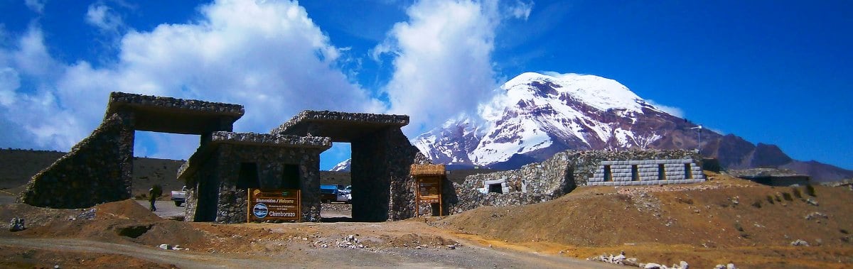
This vast reserve is located 180 km south of the capital in the province of Chimborazo.
The big attraction of this park are the 2 huge mountains: the impressive volcanic mountain Chimborazo (6310 mt), the highest snow peak in Ecuador and the Carihuarazo (5020 mt). 90% of the waters flowing from these mountains flow to the east of the country, towards the Amazon forest, the rest flows west towards the Pacific Ocean. Two large hydroelectric power stations are fed by these waters.
There are three usual access routes to the park: either you go from Riobamba to Sigsibamba or you enter the park via Abraspungo along the Ambato – Guaranda road, or you go from Riobamba via San Juan.
The Chimborazo is an extinct volcano with three peaks. Its last eruption dates back to 10,000 years ago. The ascent of the summit is reserved for experienced climbers (for more info: see our mountaineering page). There are two refuges: the first at 4800 mt to where the car hits, the second at 5000 m from where you start the climb to the top. The mountain is so high that you can see it from Guayaquil on a clear day.
The Carihuarazo has a crater of 2 km in diameter. In size it is comparable to the nearby Altar and Antisana. It may once have been the same size as the Chimborazo, but its latest eruptions topped it off.
There are several hiking trails in the park that lead you through the paramo landscapes, but given the very changeable weather and sudden fog, it is strongly discouraged to go into the mountains without a guide. A much-traveled path leads from Mocha to Mechahuasca: this tour takes two days and takes you past the glaciers of both mountains. Mountain biking has also become popular in recent years.
There are many ancient Indian villages in the park, such as San Pablo de Totorillas, Santa Teresita de Guabug and Chorrera Mirador, which you can visit along the way. Many highland Puruhua Indians still make a living there from agriculture and livestock as they did centuries ago.
Along the banks of the Colorado River (via San Juan, towards Ambato) are the thermal baths of Cununyacu at an altitude of 3600 meters. You will find three pools with warm water from the volcano.
The area is ideal for llamas, alpacas and vicuñas. You will find them everywhere and breeding programs have been set up by the government in the park.
Chat via WhatsApp